geofx runs on the hosted API: try it in the Playground.
Compile terrain heightmaps, normal maps and material masks from a .geo.toml spec, then load them into your engine.
River bend between two ridges
Generate a 512 m terrain tile with a flat riverbed winding between two ridges and distinct material rules for meadow, limestone, scree and riverbed.
Hosted output files · Draft · $0.50job_f2gekezb90j5vd8jem4g
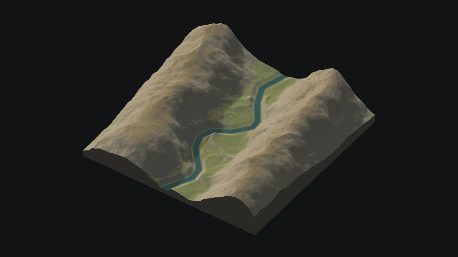
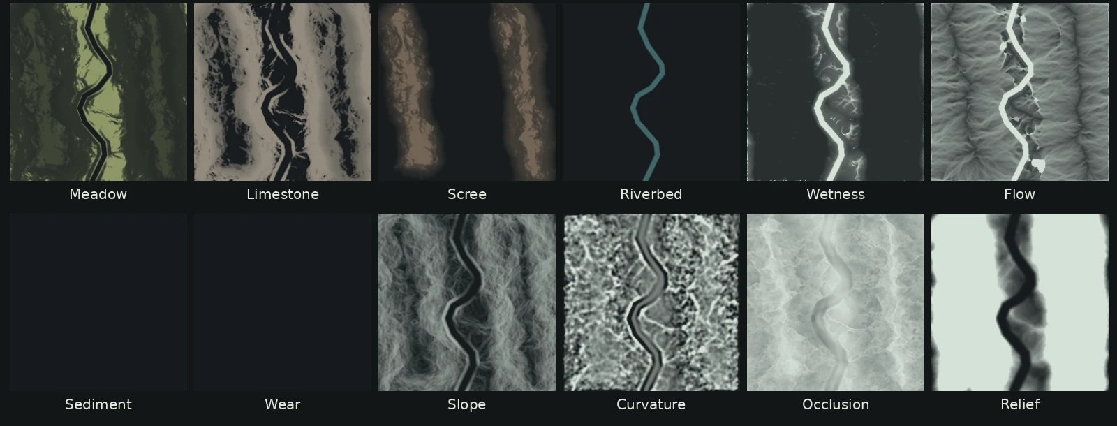
This .geo.toml spec defines a 257 by 257 simulation grid at 2 m intervals with a polyline riverbed.
# Build a valley for a level blockout. Two ridgelines frame a winding riverbed.
[meta]
name = "river_bend"
seed = 312

[grid]
size_m = [512, 512]
cell_m = 2
height_min_m = -32
height_range_m = 192

[draw]
cell_m = 1
detail_max_m = 0.8

[[shape]]
op = "warp"
scale_m = 150
warp_m = 38

[[shape]]
op = "ridge"
centre_m = [58, 32]
end_m = [121, 458]
radius_m = 22
falloff_m = 114
amplitude_m = 76

[[shape]]
op = "ridge"
centre_m = [397, 13]
end_m = [450, 470]
radius_m = 27
falloff_m = 109
amplitude_m = 92

[[shape]]
op = "ridged"
amplitude_m = 17
scale_m = 156
octaves = 5

[[shape]]
op = "noise"
amplitude_m = 5
scale_m = 65
octaves = 4

[[constraints]]
shape = "polyline"
points_m = [[244, 0], [224, 70], [247, 123], [286, 177], [288, 202], [256, 243], [216, 267], [202, 302], [217, 343], [270, 404], [274, 438], [239, 512]]
width_m = 16
falloff_m = 13
action = "flat"
height_m = 1

[[constraints]]
shape = "polyline"
points_m = [[244, 0], [224, 70], [247, 123], [286, 177], [288, 202], [256, 243], [216, 267], [202, 302], [217, 343], [270, 404], [274, 438], [239, 512]]
width_m = 12
falloff_m = 3
action = "material"
material = "riverbed"

[[materials]]
name = "meadow"
colour = [142, 151, 103]

[[materials]]
name = "limestone"
colour = [178, 167, 151]
slope_deg = [17, 38, 90, 90]
weight = 4

[[materials]]
name = "scree"
colour = [162, 138, 112]
height_m = [44, 77, 128, 156]
weight = 2

[[materials]]
name = "riverbed"
colour = [65, 103, 105]
weight = 0

[erosion]
enabled = false
filter = "gully"
amplify = 2
You get heightmaps (river_bend_height.r16 and river_bend_height.png), normal and material maps, wetness masks and godot/layout.json.
| File | What it is |
|---|---|
river_river_ | 16-bit elevation data used to displace the terrain mesh |
river_river_ | Material blend weights and zone IDs for meadow, limestone, scree and riverbed |
river_river_river_ | Surface normals and packed slope, flow and wetness masks |
river_ | Packed surface contact properties for dry friction, wet friction, softness and roughness. |
layout.json | Tile dimensions, height scales and channel mappings for engine import |
Read river_bend_height.r16 or river_bend_height.png to displace your terrain mesh, bind river_bend_normal.png and river_bend_material_w0.png to your shader, and use godot/layout.json for channel scales.
| Engine | Import |
|---|---|
| Godot | Read the .r16 file through FileAccess using the layout offset and range, and bind the PNGs to a terrain ShaderMaterial with nearest filtering for material IDs. |
| Unity | Decode the little-endian 16-bit RAW samples to normalized floats for TerrainData.SetHeights using the layout size and range, and unpack each layout channel into a TerrainLayer alphamap. |
| Unreal Engine | Import the 16-bit grayscale height PNG into Landscape with the layout scale and midpoint, and import each extracted RGBA channel as a weight-blended layer. |
| three.js | Fetch the raw bytes as an ArrayBuffer to build a 2 m height grid from the layout decode, and bind weights and masks as data textures with nearest filtering on material IDs. |
Hilly terrain tile with a road and hollow
Generate a 512 m hilly terrain tile with a road, a flat building site and a hollow.
Hosted output files · Draft · $0.50job_rh6xx4qvdbr7eedv8gc2
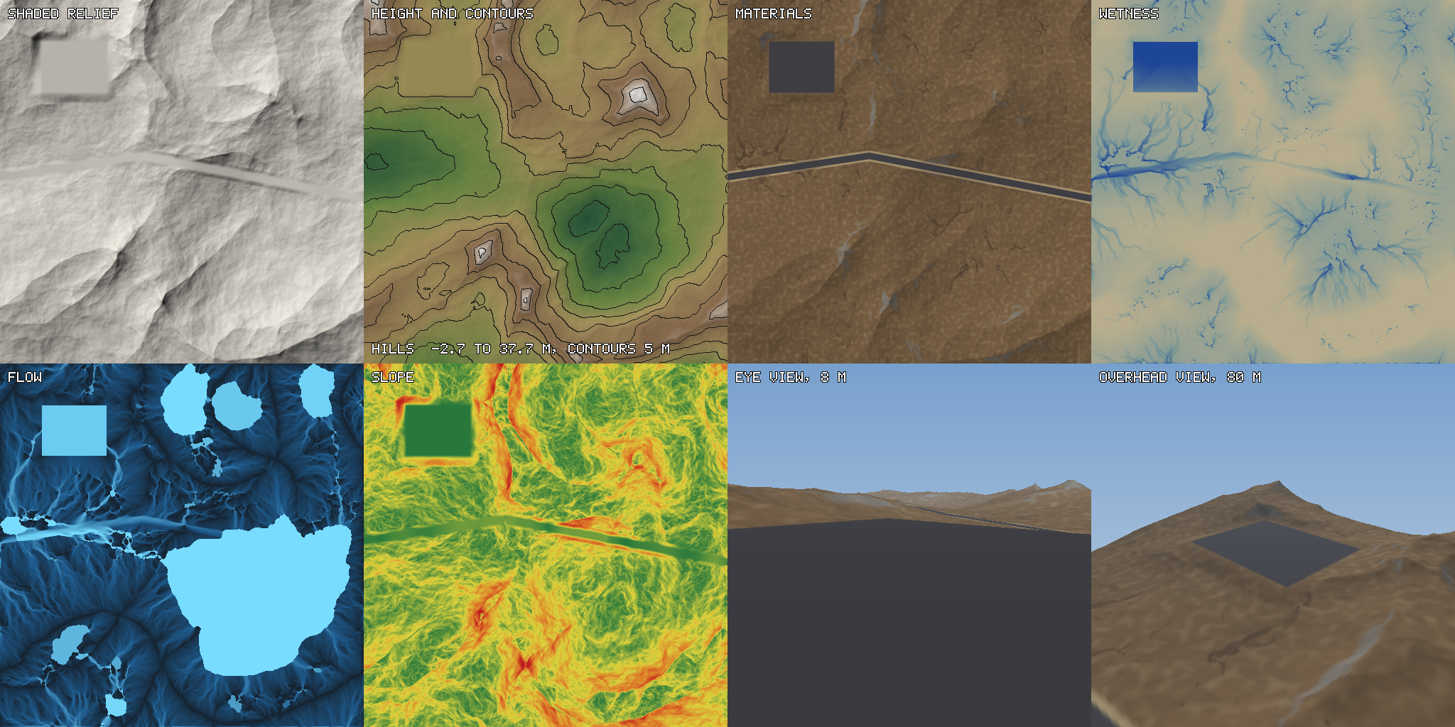
This .geo.toml spec defines a 513 by 513 simulation grid with road, site and hollow constraints.
# Procedural hills for one 512 m area, from nothing: ridges pushed about by a warp, finer noise, a hollow
# that collects water, a flat site and a graded road. No input file.
[meta]
name = "hills"
seed = 42

[grid]
size_m = [512, 512]
cell_m = 1.0

[draw]
cell_m = 0.5
detail = "noise"

[[shape]]
op = "warp"
scale_m = 256
warp_m = 40

[[shape]]
op = "ridged"
amplitude_m = 40
scale_m = 320
octaves = 7

[[shape]]
op = "noise"
amplitude_m = 6
scale_m = 96
octaves = 6

[[shape]]
op = "basin"
centre_m = [330, 340]
radius_m = 60
falloff_m = 70
amplitude_m = 10

# A flat site and a road that climbs at most 6 degrees.
[[constraints]]
shape = "polygon"
points_m = [[60, 60], [150, 60], [150, 130], [60, 130]]
action = "flat"
falloff_m = 16

[[constraints]]
shape = "polyline"
points_m = [[0, 250], [200, 220], [512, 280]]
width_m = 8
action = "flat"
slope_deg = 6
falloff_m = 8

# Gravel on both, and wear along the road.
[[constraints]]
shape = "polyline"
points_m = [[0, 250], [200, 220], [512, 280]]
width_m = 8
action = "material"
material = "gravel"
falloff_m = 1.5

[[constraints]]
shape = "polygon"
points_m = [[60, 60], [150, 60], [150, 130], [60, 130]]
action = "material"
material = "gravel"
falloff_m = 2

[[constraints]]
shape = "polyline"
points_m = [[0, 250], [200, 220], [512, 280]]
width_m = 8
action = "wear"
amount = 1

# Friction [dry, wet], softness and roughness_m: geofx.md 6.11 gives each value and its source, or says it is not sourced.
[[materials]]
name = "grass"

[[materials]]
name = "rock"
slope_deg = [28, 38, 90, 90]
weight = 2
sharpness = 2
friction = [0.75, 0.5]
softness = 0
roughness_m = 0.02

[[materials]]
name = "dirt"
wear = [0.2, 0.6, 1, 1]
weight = 3
noise_amount = 0.3
noise_scale_m = 6

[[materials]]
name = "mud"
wetness = [0.55, 0.8, 1, 1]
weight = 2
friction = [0.55, 0.45]
softness = 0.0037
roughness_m = 0.01

[[materials]]
name = "gravel"
weight = 0
friction = [0.6, 0.55]
softness = 0.005
roughness_m = 0.01

# Erosion is build stage 3; off, the example asks for nothing that is not built and bakes with no warning.
[erosion]
enabled = false
geofx outputs heightmaps (hills_height.r16 and hills_height.png), normal, material, mask and physical maps (hills_physical.png) alongside godot/layout.json.
| File | What it is |
|---|---|
hills_hills_ | 16-bit elevation data used to displace the terrain mesh |
hills_hills_hills_ | Material blend weights and zone IDs for the hills tile |
hills_hills_hills_ | Surface normals and packed slope, flow and wetness masks |
hills_ | Packed surface contact properties for dry friction, wet friction, softness and roughness. |
layout.json | Tile dimensions, height scales and channel mappings for engine import |
Read hills_height.r16 or hills_height.png to displace terrain, bind hills_normal.png, material weights and hills_physical.png to your shader, and use godot/layout.json for channel scales.
| Engine | Import |
|---|---|
| Godot | Read the .r16 file through FileAccess using the layout offset and range, and bind the PNGs to a terrain ShaderMaterial with nearest filtering for material IDs. |
| Unity | Decode the little-endian 16-bit RAW samples to normalized floats for TerrainData.SetHeights using the layout size and range, and unpack each layout channel into a TerrainLayer alphamap. |
| Unreal Engine | Import the 16-bit grayscale height PNG into Landscape with the layout scale and midpoint, and import each extracted RGBA channel as a weight-blended layer. |
| three.js | Fetch the raw bytes as an ArrayBuffer to build a height grid at the spacing in the layout from the layout decode, and bind weights and masks as data textures with nearest filtering on material IDs. |
Questions
What does the River Bend geofx example generate?
River Bend generates a 512 m terrain tile with a 257 by 257 simulation grid at 2 m intervals and a polyline riverbed.
Which material zones are included in the River Bend terrain?
The River Bend spec defines material rules and blend weights for meadow, limestone, scree and riverbed across the valley.
What surface properties are packed into the River Bend physical map?
The physical PNG packs dry friction, wet friction, softness and roughness values for surface contact alongside wetness and slope masks.